
28th Feb 2009-Saturday
As usual path finder starts journey alone humming a song “Ekla Chalo Re” of Ravindranath Tagor towards Aurangabad (Khadki).
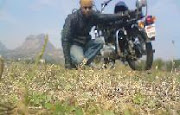
My first destination was Shirdi which is around 270KM from Mumbai. I started at 9.00 am from Vikhroli (Mumbai).I took Igatpuri-Ghoti-Sinnar way to reach Shirdi because I want a peaceful ride instead of via Nashik. Igatpuri is surrounded by the highest peaks of Sahyaadri i.e. Western Ghats, Forts built in this area most of them are of Satavahana dynasty. It's heavenly for trekkers and hikers. Government has developed this hill area. We can see Dams, Windmills here to utilize maximum nature resources. And now this area is producing good quality of Rice, Wheat, Sugar canes and red chilies. Long queue of windmills on top of the mountains looks very beautiful, this windmills were dancing on wind music. I stopped there to capture their dance in my cam.

I reach Shirdi at 2.00 pm. I took blessings of Saibaba for my further journey, now I am ready to conquer the world.

Around 4.30 pm I started again and via Kopargoan reached Verul (Ellora) at 7.00 pm. It was 90 KM ride. While reaching Verul I was enjoying beautiful and peaceful rural life of Aurangabad, fields of Cotton, Sugar canes, Wheat, queues of Bullock carts. I saw an ancient Indian machinery which is still in use for many purposes like milking sugar cane. As Visitor’s entry is stopped at 5.00 pm in Verul caves, I decided to halt at Verul only. I got a good room in reasonable rate. I went to sleep as soon as I deep into the bed.
Distance covered: 390 KM
01 Mar 2009-Sunday
Good morning Verul. It was truly a great morning. As I entered in a Verul a beautiful Peacock crossed my path. And my whole day was like that peacock, beautiful!
For me Verul caves are like testy khichadi of Indian culture. Consist of Hindu, Jain and Buddha religion, all caves are full of beautiful marvelous sculptures but after entering a cave 16 you will definitely say Marvelous! It is a traditional in Shiva temple, each corner of temple is sheer artistic example. It is Kailasanatha Temple; Bhagwan Shankar’s different avatars have been sculpted on the walls. There are total 34 caves, 12 Buddhist (caves 1-12), 17 Hindu (caves 13-29) and 5 Jain caves (caves 30-34). Also first time I saw a beautiful statue of tridev Brahma, Vishnu and Mahesh together.

 After Ellora I moved towards Ghrishneshwar Mandir of lord Shiva which is just a kilometer away from Verul. Whole temple is made up of Red Stone, this beautifully designed and curved temple is a best example of Hemadpanthi Architecture. The Ghrishneshwar temple was re-constructed by Maloji Raje Bhosale of Verul, (grandfather of Chhatrapati Shivaji Maharaj) in the 16th century and later by Ahilyabai Holkar in 18th century, who also re-constructed the Kashi Vishwanath temple at Benares, and the Vishnu Paada temple at Gaya. Outside temple you can see a beautiful tomb of Maloji raje bhosale.
 After taking blessings of Ghrishneshwar I moved out from Verul to Reach Devgiri (Daulatabad); capital of Yadavas, capital of Muhammad Tughlaq, Sultan of Delhi. Daulatabad was a capital of India for 2 years in Muhammad Tughlaq’s time.This magnificent 12th century fortress stands on a hill just 13 km. from Aurangabad.One of the world's best preserved fort of medieval times, surviving virtually unaltered, Daulatabad yet displays the character that made it invincible. This fort is surrounded by a huge and strong safety walls and Khandak’s. Some old canons are still present there.
I went through 'bhul bhullaiya' lonely, I took 15-20 min to come out from it. It was achievement for me to come out from ‘Bhul Bhullaiya’ without torch and guide, not advisable though. Scary bhul bhullaiya cave was full of Bats and their dirt. “Chand Minar” in Daulatabad was built in the Turkish style in 1435 by Ala-ud-din Bahmani to celebrate his occupation of the fort. This minaret is an outstanding example of Islamic art. This 30-metre high tower is a second tallest minar in India.

My eyes were satisfied, now my stomach is crying for it….satisfaction! I had Alu-Parotha and sugar cane juse. If it is your good day then you will get all awesome things in a single day. Alu-Parotha and curd was awesome, sweet sugar cane juse was like cherry on top of hot cake.
Now I ready to move towards Ajantha, but after 3 KM I saw a beautiful temple after Khultabad fort. It was ‘Bhadra Maruti’s’ temple. This is one of the two places where Lord Hanuman is in sleeping position.
Story:
“Khultabad previously known by the name of Badravati Nagar was ruled by King Bhadrasen, a kind and pious man. King Bhadrasen used to sit singing bhajans in praise of Lord Hanuman on the banks of Bhadrakund Talab. One day while the King was singing the devotional songs, Lord Hanuman appeared in front of him. Listening to the captivating music, he fell asleep on the ground. Later, Lord Hanuman pleased by the astute devotion of King Bhadrasen, granted him a wish. The good King desired that the Lord would stay there forever and fulfill the desires of all his devotees. Lord Hanuman granted the wish and disappeared. Much later, an idol of Lord Hanuman in a sleeping posture was found where he had stood. That’s how the name Bhadra Maruti or ‘Sleeping Hanuman’.”
I had to drive continuously 2 hours to reach Ajantha which was around 100 KM away. I reach Ajantha by 3.00 pm. MTDC department is not allowing any private vehicle in Ajantha; you have to go by ST bus.
Caves are maintained very beautifully. Actually it was wrong time to visit Ajantha, best time is monsoon. The caves are in a wooded and rugged horseshoe-shaped ravine about 3½ km from the village of Ajantha. There are 29 Buddhist caves, out of them 4 caves are incomplete. The monastic complex of Ajanta consists of several viharas and chaitya-grihas. All caves are full of beautifully painted pictorial stories of Buddha’s life and Buddha’s sculptures. Various places the art work has become eroded due to decay and human interference. Therefore, many areas of the painted walls, ceilings, and pillars are fragmentary.
Sleeping Buddha’s statue is most beautiful sculpture. You can see live expression on his face. Expressions of Peace and satisfaction, Buddha leave his palace in search of both this things and I think he got it as no one else. I think we all are running to get careless, peaceful sleep but we never got that and that’s why we all just running behind it.
 While coming from Ajantha caves back I saw Ajantha Village, a perfect example of ancient village. That time big, important villages were surrounded by safety wall like fort.
I reach Aurangabad at 7.30 pm in evening; I hired a room in a guest house at reasonable rate.
My day is ended with a full of satisfaction as I saw two man made marvels, and a place which was known to be the safest place but unfortunately it wasn’t. Om Namo Buddhaye Namaha!
Distance covered: 245 KM
02 Mar 2009-Monday
Aurangabad is truly said to be a 'City of Gates' as one can not miss the strong presence of these as one drives through the city. The city was founded in 1610 A, D. by Malik Ambar, the Prime Minister of Murtaza. Nizam Shah of Ahmadnagar on the site of a village called Khirki. In 1653 when Prince Aurangzeb was appointed the viceroy of the Deccan for the second time, he made Fatehnagar his capital and called it Aurangabad. A Mughal emperor comes here to destroy Maratha kingdom but he couldn’t, he destroyed himself. We can see lot footprints of Mughals, Nijams and Yadavas Empire in city. Hindu and Muslims are staying happily together since many years.
Passing through the city finally I reach my last spot journey Bibi-Ka-Maqbara.
This beautiful structure is an exact copy of Taj Mahal. This master peace of architecture is made up of white marble. Bibi Ka Maqbara is a Maqbara built by Prince Azam Shah, son of Emperor Aurangzeb, in the late 17th century as a loving tribute to his mother, Dilras Bano Begam.I was just assuming the beauty of Taj of Agra while walking in garden of Bibi-ka-Maqbara. This Monument is also called as Dakkhani Taj. The curved nakkashi is just amazing.
Now it is a time to say good bye Aurangabad and hit the road again towards my home Mumbai. Again out of the route I choose Nevasa-Sangamner-Bhandardar-Ghoti-Igatpuri route to reach Mumbai.
In returning journey I waited at Pravara sangam, a beautiful sight where Pravara and Godavari rivers are confluences. Then I moved ahead till Randha fall of Bhandardara reign. It was amazing, adventures ride from Sangamner to Ghoti, curvy roads taking me up and down on the mountains. I went through base of Kalsubai, Bari Village; Kalsubai is the highest peak of the Sahyadris. I am aiming towards it in next season. Despite sun was right on top of my head, I was challenging his heat with my speed. Guys tell you what; you can not compare Royal Enfield with any other bike. It is pleasure to ride Bullet on such curvy tracks. Meanwhile I stopped at Randha Falls, to decrease temperature of my body by having bath in cold water.
This Randha, Bhandardara dams made this mountain area as a very productive area.
Finally after having lunch in Igatpuri I was cruising towards my home. This session of bike ridding tested my patience, the road was laterally burning, worm wind attacking me from everywhere. It was the hottest road I have ever driven on. Before sun reaches his home I reached mine.
Distance covered: 412 KM
Total Distance Covered: 1047 KM app.
Total Expense: 2500 /- Rs (Including fuel)
Avg. Speed: 50-60 KM / HR, I decided to maintain 60 avg speeds throughout the journey as my bike went through a heart surgery just 3 days before, and I succeeded.
My Route:
1st day: Mumbai-Igatpuri-Sinnar-Shirdi-Kopargoan-Verul
2nd day: Verul-Daulatbad-Sillod-Ajantha-Sillod-Aurangabad
3rd day: Aurangabad-Nivasa-Sangamner-Akole-Bhandardara-Igatpuri-Mumbai


 After Ellora I moved towards Ghrishneshwar Mandir of lord Shiva which is just a kilometer away from Verul. Whole temple is made up of Red Stone, this beautifully designed and curved temple is a best example of Hemadpanthi Architecture. The Ghrishneshwar temple was re-constructed by Maloji Raje Bhosale of Verul, (grandfather of Chhatrapati Shivaji Maharaj) in the 16th century and later by Ahilyabai Holkar in 18th century, who also re-constructed the Kashi Vishwanath temple at Benares, and the Vishnu Paada temple at Gaya. Outside temple you can see a beautiful tomb of Maloji raje bhosale.
 After taking blessings of Ghrishneshwar I moved out from Verul to Reach Devgiri (Daulatabad); capital of Yadavas, capital of Muhammad Tughlaq, Sultan of Delhi. Daulatabad was a capital of India for 2 years in Muhammad Tughlaq’s time.This magnificent 12th century fortress stands on a hill just 13 km. from Aurangabad.One of the world's best preserved fort of medieval times, surviving virtually unaltered, Daulatabad yet displays the character that made it invincible. This fort is surrounded by a huge and strong safety walls and Khandak’s. Some old canons are still present there.
 While coming from Ajantha caves back I saw Ajantha Village, a perfect example of ancient village. That time big, important villages were surrounded by safety wall like fort.

Wonderful to read your experience. Brought back memories as we did similar trip to Aurangabad back in 2007. By the way do you remember by any chance little temple that was on the bank of a river which I assume was Godavari river, it somewhat got stuck in our memories but we don't remember its name. All we recall was that it was also a bird sanctuary for ornithologists. We have some pictures of it which I could send you. I really would like to find out it's name or at least the town it was located in. Judging the map I think it was Pravara Sangambut but I am not sure and would love to find out.
ReplyDeleteHappy journey!
Maggie